18/05/2006
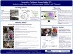
Communication à Plymouth

students create their own “virtual geological field trip” with ©Geonote
One of the most interesting challenges in using ICT in the classroom is perhaps to consider that technology allows teachers to imagine news student activitie

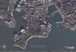
 Geonote can be used in two ways. The visualization mode allows students to deal with geological data by using the available tools or to shift to edition mode and to create their own “virtual geological field trip” by creating new geological data and by georeferencing those data on a map.
Mercredi 10 mai 2006, communication à Plymouth dans le cadre du séminaire :
 télécharger le poster de la communication (pdf)
To download the poster of the communication (pdf)
22:10 Publié dans Ecole de terrain/Fieldwork | Lien permanent | Commentaires (0)
08/04/2006
Ecole de terrain à Djibouti
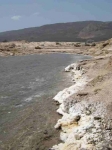
31 mars 2006, une formation à Djibouti est l'occasion d'une excursion vers le Goubet et le lac Assal. Pour reprendre les mots de Tazieff :
"Djibouti est un livre de géologie à ciel ouvert".
°
°
°
Pour connaître la géologie de le région, LE site incontournable : http://www.jpb-imagine.com/djibgeol/
00:10 Publié dans Ecole de terrain/Fieldwork | Lien permanent | Commentaires (0)
27/02/2006
European Geosciences Union
 European Geosciences Union
General Assembly 2006
Vienna, Austria, 02 – 07 April 2006
Wednesday, 5 April 2006
Lecture Room:30
14:00 - 14:15
EGU06-A-00889; ES3-1WE3O-003
Sanchez, E.; Prieur, M.
Teaching Geosciences In France - An Inquiry About Teachers And Students During Fieldwork Courses

21:41 Publié dans Ecole de terrain/Fieldwork | Lien permanent | Commentaires (0)


